
Cartes géographiques et atlas
- 216 Atlas
- 5826 Cartes géographiques
- 243 Plans
Date de sortie
- 6375 tous
- publiés
- 158 moins de 3 mois
- 60 moins d'un mois
- 15 moins d'une semaine
- 61 à paraître
- 11 dans la semaine qui vient
- 36 dans le mois qui vient
Disponibilité
Prix
- 85 inférieur à 5 €
- 1144 de 5 à 10 €
- 2741 de 10 à 20 €
- 2316 de 20 à 40 €
- 85 supérieur à 40 €
-
![Série bleue [nouveau format], 2335SB, 2335Sb Pleaux/St-Cernin Salers](//cdn.leslibraires.fr/XyICsuvRofthl1P3DaLRsbP9opgwaP3SwkVAoKm2WVM/s:200:200/Njc2MTkwNw.webp) Série bleue [nouveau format], 2335SB, 2335Sb Pleaux/St-Cernin SalersXxxIGN – Institut Géographique National13,90
Série bleue [nouveau format], 2335SB, 2335Sb Pleaux/St-Cernin SalersXxxIGN – Institut Géographique National13,90 -

-

-
![Série bleue [nouveau format], 2236SB, 2336Sb Aurillac/Laroquebrou/Barrage De St Etienne/](//cdn.leslibraires.fr/ObxBxSmxnrpZ_S-WZz8qtrm2ho-p-ClAwLrQPy59pho/s:200:200/Njc2MTkxNw.webp) Série bleue [nouveau format], 2236SB, 2336Sb Aurillac/Laroquebrou/Barrage De St Etienne/XxxIGN – Institut Géographique National13,90
Série bleue [nouveau format], 2236SB, 2336Sb Aurillac/Laroquebrou/Barrage De St Etienne/XxxIGN – Institut Géographique National13,90 -

-

-
![Série bleue [nouveau format], 2235SB, 2235Sb Argentat](//cdn.leslibraires.fr/G3fpcvfDROabw7w_DMIwNoMQdaUSa3274opfu0VUX04/s:200:200/NjE1MTAyNg.webp) Série bleue [nouveau format], 2235SB, 2235Sb ArgentatXxxIGN – Institut Géographique National13,90
Série bleue [nouveau format], 2235SB, 2235Sb ArgentatXxxIGN – Institut Géographique National13,90 -

-

-

-

-

-
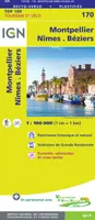 Top 100, 170, Top100170 Montpellier / Nimes / Beziers 1/100.000XxxIGN – Institut Géographique National8,40
 -
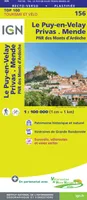 Top 100, 156, Top100156 Le-Puy-En-Velay / Privas / Mende 1/100.0XxxIGN – Institut Géographique National8,40
 -
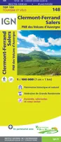 Top 100, 148, Top100148 Clermont-Ferrand / Salers 1/100.000XxxIGN – Institut Géographique National8,40
 -

-
 Top 25 : une carte, un site, 3633ET, 3633Et Tignes.Val-D'Isère.Haute Maurienne.Pn De LaCollectifIGN – Institut Géographique National13,90
 -

-
![Série bleue [nouveau format], 2333SB, 2333Sb Bort-Les-Orgues.Neuvic](//cdn.leslibraires.fr/_2R8JG6cz1rrphBqlEHmB4xkAQE1aYJ6nhV7Zb4qHPE/s:200:200/NjE1MTAzNA.webp) Série bleue [nouveau format], 2333SB, 2333Sb Bort-Les-Orgues.NeuvicXxxIGN – Institut Géographique National13,90
Série bleue [nouveau format], 2333SB, 2333Sb Bort-Les-Orgues.NeuvicXxxIGN – Institut Géographique National13,90 -
![Série bleue [nouveau format], 2334SB, 2334Sb Mauriac.Ydes](//cdn.leslibraires.fr/b8D-HO1kru5D2GE8GkDXtPH2C54MmW7Tif0Vraf_Bnc/s:200:200/NjE1MTAyMg.webp) Série bleue [nouveau format], 2334SB, 2334Sb Mauriac.YdesXxxIGN – Institut Géographique National13,90
Série bleue [nouveau format], 2334SB, 2334Sb Mauriac.YdesXxxIGN – Institut Géographique National13,90 -
![Série bleue [nouveau format], 2636SB, 2636Sb Saugues](//cdn.leslibraires.fr/vbk1eiFddTKSQyV9V5i8zBptz_XXNoUn15NyGb7pJiU/s:200:200/NjE1MTA0OA.webp)
-
![Série bleue [nouveau format], 2337SB, 2337Sb Montsalvy](//cdn.leslibraires.fr/byfLw44RkwnLgPb1g0BrtKvIvvgQWwva1l95seQq5yw/s:200:200/NjE1MTAzMw.webp) Série bleue [nouveau format], 2337SB, 2337Sb MontsalvyXxxIGN – Institut Géographique National13,90
Série bleue [nouveau format], 2337SB, 2337Sb MontsalvyXxxIGN – Institut Géographique National13,90 -
![Série bleue [nouveau format], 2638SB, 2638Sb Mende.Marvejols](//cdn.leslibraires.fr/3uUKvm1C3zBFqDRldAcDMHQewTPIYUfTSV2miCgHDcw/s:200:200/NjE1MTAzNQ.webp) Série bleue [nouveau format], 2638SB, 2638Sb Mende.MarvejolsXxxIGN – Institut Géographique National13,90
Série bleue [nouveau format], 2638SB, 2638Sb Mende.MarvejolsXxxIGN – Institut Géographique National13,90 -
![Série bleue [nouveau format], 2637SB, 2637Sb St-Chely-D'Apcher](//cdn.leslibraires.fr/jqhV2qvBOdipagpQTmnynRXfwo4LTHIPJHpgYLn3crg/s:200:200/NjE1MTA0Mw.webp) Série bleue [nouveau format], 2637SB, 2637Sb St-Chely-D'ApcherXxxIGN – Institut Géographique National13,90
Série bleue [nouveau format], 2637SB, 2637Sb St-Chely-D'ApcherXxxIGN – Institut Géographique National13,90
![Série bleue [nouveau format], 2335SB, 2335Sb Pleaux/St-Cernin Salers](http://cdn.leslibraires.fr/XyICsuvRofthl1P3DaLRsbP9opgwaP3SwkVAoKm2WVM/s:200:200/Njc2MTkwNw.webp)


![Série bleue [nouveau format], 2236SB, 2336Sb Aurillac/Laroquebrou/Barrage De St Etienne/](http://cdn.leslibraires.fr/ObxBxSmxnrpZ_S-WZz8qtrm2ho-p-ClAwLrQPy59pho/s:200:200/Njc2MTkxNw.webp)


![Série bleue [nouveau format], 2235SB, 2235Sb Argentat](http://cdn.leslibraires.fr/G3fpcvfDROabw7w_DMIwNoMQdaUSa3274opfu0VUX04/s:200:200/NjE1MTAyNg.webp)


![Série bleue [nouveau format], 2333SB, 2333Sb Bort-Les-Orgues.Neuvic](http://cdn.leslibraires.fr/_2R8JG6cz1rrphBqlEHmB4xkAQE1aYJ6nhV7Zb4qHPE/s:200:200/NjE1MTAzNA.webp)
![Série bleue [nouveau format], 2334SB, 2334Sb Mauriac.Ydes](http://cdn.leslibraires.fr/b8D-HO1kru5D2GE8GkDXtPH2C54MmW7Tif0Vraf_Bnc/s:200:200/NjE1MTAyMg.webp)
![Série bleue [nouveau format], 2636SB, 2636Sb Saugues](http://cdn.leslibraires.fr/vbk1eiFddTKSQyV9V5i8zBptz_XXNoUn15NyGb7pJiU/s:200:200/NjE1MTA0OA.webp)
![Série bleue [nouveau format], 2337SB, 2337Sb Montsalvy](http://cdn.leslibraires.fr/byfLw44RkwnLgPb1g0BrtKvIvvgQWwva1l95seQq5yw/s:200:200/NjE1MTAzMw.webp)
![Série bleue [nouveau format], 2638SB, 2638Sb Mende.Marvejols](http://cdn.leslibraires.fr/3uUKvm1C3zBFqDRldAcDMHQewTPIYUfTSV2miCgHDcw/s:200:200/NjE1MTAzNQ.webp)
![Série bleue [nouveau format], 2637SB, 2637Sb St-Chely-D'Apcher](http://cdn.leslibraires.fr/jqhV2qvBOdipagpQTmnynRXfwo4LTHIPJHpgYLn3crg/s:200:200/NjE1MTA0Mw.webp)